Garmin Marine
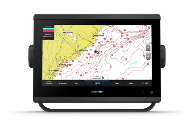
Garmin GPSMAP 1022xsv 10" Chartplotter Sounder
PN 010-01740-02
10" display
$2,180.91 $2,109.09
Not sure it fits your boat? We check compatibility before you pay — ask us
 1 / 6
1 / 6 You save $327.28 (8%)
Out of stock — ask about lead time
Ask about availabilityNothing charged online — we email an invoice with shipping confirmed.
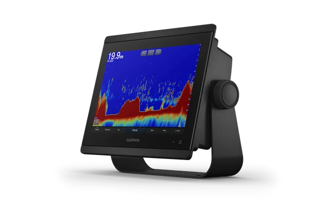
This 12” chartplotter gives you clean sonar, fast performance and detailed mapping - everything you need to find fish and navigate confidently offshore.
Want to take it to the next level?
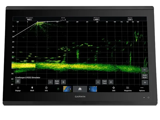
This unit pairs perfectly with Garmin LiveScope XR systems for real-time sonar.
This unit comes ready with Garmin Navionics+ mapping already loaded - giving you detailed coastal charts, depth contours and Auto Guidance+ straight out of the box.
No extra purchases, no setup headaches - just power it up and go fishing.
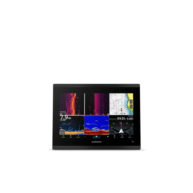
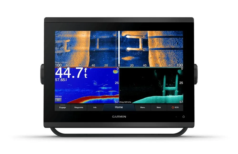
The GPSMAP 1253xsv supports CHIRP, ClearVü and SideVü sonar, along with up to 1kW traditional sonar - giving you proper fish separation and structure detail offshore.
The Navionics+ mapping gives you detailed coastal and inland charts with Auto Guidance+ for smarter navigation and route planning.
It’s ideal for:
You get clean sonar returns, detailed charts and a system that actually works when you’re out wide chasing fish.
This is where the real difference is - not just the unit, but how it’s installed and set up.
Not sure what you need? Tell us about your boat & get the right setup
Ready to upgrade? View Supply & Install Packages
Start Your Setup Plan
The GPSMAP 1253xsv with Navionics+ is one of the best all-round setups for serious fishos wanting performance without overcomplicating things.
The 1253xsv brings together:
Crisp 12″ touchscreen chartplotter
Built-in high-wide sonar
Garmin Navionics cartography support
Clear coastal and inland navigation
Easy waypoint and route management
This isn’t just a gadget - it’s a navigation and fishing powerhouse when set up right.
Anyone can sell you a screen - but the difference real boaties see is in:
Correct transducer matching and placement
Power supply and voltage stability
Safe, clean mounting
Garmin network and Navionics chart setup
Getting all that right offshore is the difference between frustration and confidence.
The Garmin GPSMAP 1253xsv paired with Garmin Navionics charts is a premium marine GPS chartplotter and sounder combo - ideal for offshore fishermen, coastal cruisers and serious boaties who demand clarity, accuracy and reliable performance on the water.
| Display size |
10.3" x 6.4"; 12.1" diagonal (26.2 x 16.3 cm; 30.7 cm diagonal) |
| Display resolution | 1280 x 800 pixels |
| Physical dimensions | 12.1” x 8.9” x 3.2” (30.8 x 22.8 x 8.2 cm) |
| Receiver | 10 Hz high-sensitivity |
| Water rating | IPX7 |
| Weight |
6.6 lbs. (3.0 kg) |
| Mounting options | Bail or flush |
| Display type | WXGA display |
| Antenna | Internal or external over NMEA 2000 |
| Routes | 100 |
| Track log | 50,000 points; 50 saved tracks |
| Preloaded maps |
BlueChart® g3 (coastal maps) |
| Accepts data cards |
2 microSD™ cards (back of unit) |
| ClearVü | Yes with CHIRP (built-in) |
| Waypoints | 5,000 |
| Wireless connectivity | Yes |
| Transmit power | 1 kW traditional; 1 kW CHIRP |
| NMEA 0183 compatible | Yes |
| Water temperature log and graph | Yes |
| GCV™ Black Box sonar support | Yes |
| Wireless mouse compatible | No |
| NMEA 0183 input ports |
1 |
| Dual-beam (77/200 kHz) sonar capable | Yes |
| Supports DSC (displays position data from DSC-capable VHF radio) | Yes |
| J1939 Compatible | Yes |
| Additional |
|
| NMEA 2000® compatible | Yes |
| ActiveCaptain compatible | Yes |
| Supports AIS (tracks target ships position) | Yes |
| Sonar recording | Yes |
| Polarised Support | Yes |
| Garmin Marine Network™ ports |
2 |
| Garmin Sonar compatible |
Yes (built-in) |
| Frequencies supported |
Traditional: 50/77/83/200 kHz |
| GSD™ Black Box sonar support | Yes |
| Sonar history rewind | Yes |
| Garmin SmartMode compatible (customizable monitor presets) | Yes |
| Wireless remote compatible | Yes |
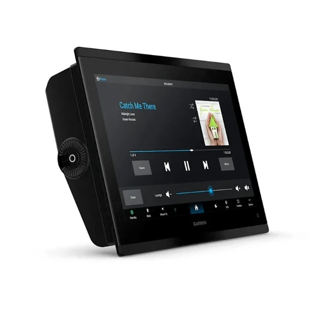
| Supports FUSION-Link™ compatible radios | Yes |
| Maximum depth | 5,000 ft at 1kW (depth capacity is dependent on water bottom type and other water conditions) |
| Dual-frequency (50/200 kHz) sonar capable | Yes |
| Transducer pin numbers | 12-pin (orange) |
| Bottom lock (shows return from the bottom up) | Yes |
| NMEA 0183 output ports |
1 |
| Tide tables | Yes |
| SiriusXM™ Weather & Radio compatible | Yes |
| Power consumption |
Max power usage at 10 Vdc: 26.5 W Typical current draw at 12 Vdc: 1.7 A Max current draw at 12 Vdc: 2.2 A |
| Garmin Radar compatible | Yes |
Frequently Asked Questions – Garmin GPSMAP 1253xsv
Can this unit integrate with sonar and radar?
A: Yes. Garmin GPSMAP 1253xsv supports Garmin sonar and (depending on model) networked radar, AIS and autopilot integration.
Can I add LiveScope later? - Absolutely. This unit fully supports LiveScope and other Garmin upgrades.
Is this good for offshore fishing? Yep - its a perfect mid sized unit with enough screen space for charts, sonar and radar.
Does this come with Charts? - Yep includes Garmin Navionics+ with detailed mapping and updates.
Does it include sonar? Yep - its got built in CHIRP, ClearVu and SideVu sonar (with transducer required for full performance.
| Display size | 10.3" x 6.4"; 12.1" diagonal (26.2 x 16.3 cm; 30.7 cm diagonal) |
|---|---|
| Display resolution | 1280 x 800 pixels |
| Physical dimensions | 12.1” x 8.9” x 3.2” (30.8 x 22.8 x 8.2 cm) |
| Receiver | 10 Hz high-sensitivity |
| Water rating | IPX7 |
| Weight | 6.6 lbs. (3.0 kg) |
| Mounting options | Bail or flush |
| Display type | WXGA display |
| Antenna | Internal or external over NMEA 2000 |
| Routes | 100 |
| Track log | 50,000 points; 50 saved tracks |
| Preloaded maps | BlueChart® g3 (coastal maps) |
| Accepts data cards | 2 microSD™ cards (back of unit) |
| ClearVü | Yes with CHIRP (built-in) |
| Waypoints | 5,000 |
| Wireless connectivity | Yes |
| Transmit power | 1 kW traditional; 1 kW CHIRP |
| NMEA 0183 compatible | Yes |
| Water temperature log and graph | Yes |
| GCV™ Black Box sonar support | Yes |
| Wireless mouse compatible | No |
| NMEA 0183 input ports | 1 |
| Dual-beam (77/200 kHz) sonar capable | Yes |
| Supports DSC (displays position data from DSC-capable VHF radio) | Yes |
| J1939 Compatible | Yes |
| Additional | USB port: 1 |
| NMEA 2000® compatible | Yes |
| ActiveCaptain compatible | Yes |
| Supports AIS (tracks target ships position) | Yes |
| Sonar recording | Yes |
| Polarised Support | Yes |
| Garmin Marine Network™ ports | 2 |
| Garmin Sonar compatible | Yes (built-in) |
| Frequencies supported | Traditional: 50/77/83/200 kHz CHIRP (low, medium, high) ClearVü/SideVü (260/455/800 kHz) (dependent on transducer) |
| GSD™ Black Box sonar support | Yes |
| Sonar history rewind | Yes |
| Garmin SmartMode compatible (customizable monitor presets) | Yes |
| Wireless remote compatible | Yes |
| Supports FUSION-Link™ compatible radios | Yes |
| Maximum depth | 5,000 ft at 1kW (depth capacity is dependent on water bottom type and other water conditions) |
| Dual-frequency (50/200 kHz) sonar capable | Yes |
| Transducer pin numbers | 12-pin (orange) |
| Bottom lock (shows return from the bottom up) | Yes |
| NMEA 0183 output ports | 1 |
| Tide tables | Yes |
| SiriusXM™ Weather & Radio compatible | Yes |
| Power consumption | Max power usage at 10 Vdc: 26.5 W Typical current draw at 12 Vdc: 1.7 A Max current draw at 12 Vdc: 2.2 A |
| Garmin Radar compatible | Yes |
Garmin Marine
PN 010-01740-02
Garmin Marine
PN 010-01741-02
 Sale −11%
 Garmin Marine
PN 010-02366-04